CSUMB hosted its own hackathon in November 2016, and the theme was solving community problems using "games". My idea was to use the Unity Game Engine to create an interactive map of the campus with simple GPS functions to help new students find their way around.
I still think I cheated a little, since what I created wasn't really a game by any stretch of the imagination, but I'd like to think it turned out a fair bit more helpful than if I had actually tried to shoehorn it into one. The hackathon lasted two days - and as I awkwardly sputter in the local news real, it ended up being an all-nighter. Dispite that, it was genuinely one of the most fun experiences I've had at a hackathon regardless of the win.
Progress
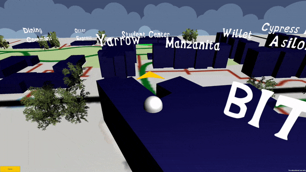
Though ugly as sin due to the strict timeframe, the app ended up having two main "modes" - The first was simple navigation mode that took your current location and desired building and gave you a little arrow telling you which way to go. The second was a "tour" mode that navigated you to the student center in the middle of campus, then navigated you to all of the points of interest on campus, giving you a little popup of info about each one as you arrive at them.
How It Works
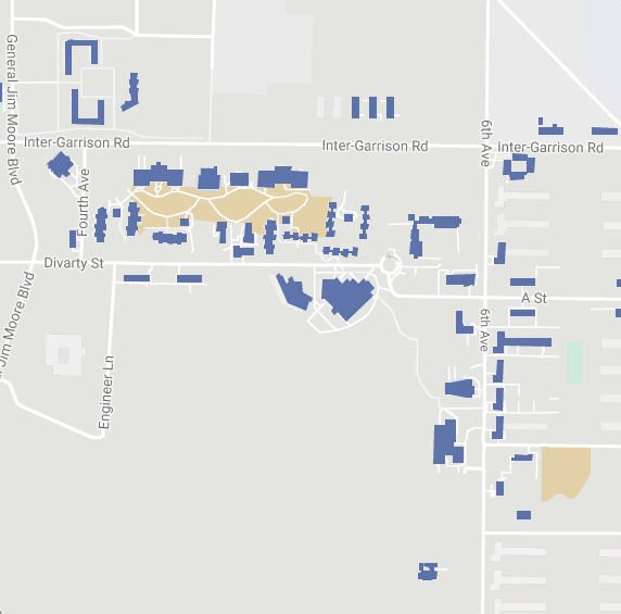
We first thought it would be useful to just use a google maps map of the campus to base the app on, but we quickly burned that bridge, as a rookie mistake of accessing the google maps API 60 times per second got us blacklisted pretty quick. We then decided the next best thing was to just create our own map and calibrate the scale ourselves. We also created loose 3D models of each building to help identify them. The hard part was accessing the phone's GPS position and calibrating that with our handmade map. It took a fair amount of trial and error - running outside and accross campus at 3AM to see if it was accurately following us.